
Beyond the Field:
How digital technologies transform outcrop studies
WEBINAR
25th September 2025 19:00 GMT
by Dave Hodgetts (VRGeoscience)
Abstract
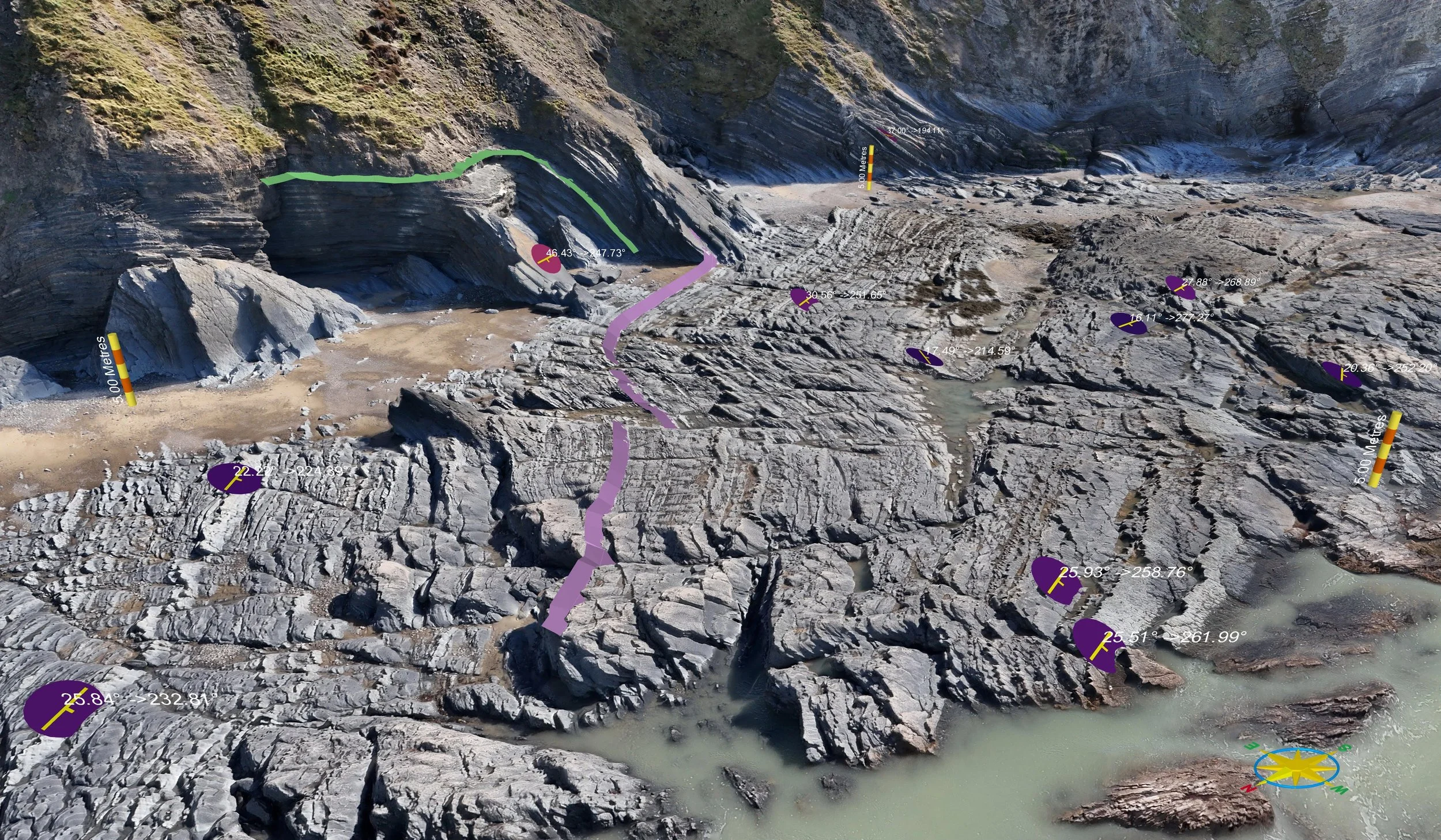
Digital technologies are reshaping the way geoscientists engage with outcrops, extending analysis beyond traditional fieldwork. Photogrammetry, drones, lidar, and immersive visualization platforms now enable geologists to capture, share, and interrogate outcrops with unprecedented detail. This presentation examines how digital outcrop models and virtual environments are enhancing accessibility, fostering collaboration, and strengthening education and training. Far from replacing fieldwork, these tools act as a powerful complement to it by broadening the scope of geological investigation, lowering logistical barriers, and transforming the way geological knowledge is communicated across research, industry, and classrooms.

Biography
David is a geoscientist and software developer, with a strong academic foundation in geology, geostatistics, and numerical modelling, along with a wealth of hands-on experience in geocellular modelling. His academic journey led me through a degree in geology, an MSc in Computing in Earth Sciences, and a PhD in Geodynamics. Following a postdoctoral position focusing on seismic interpretation, he moved towards digital outcrop and geocellular modelling. As a former lecturer in reservoir modelling at the University of Manchester, David cultivated deep expertise in digital outcrop modelling. This allowed him to work extensively with LiDAR and photogrammetry, and apply outcrop analogues to subsurface challenges.
David is CEO of VRGeoscience Limited, UK., a spin out company from the University of Manchester Innovation Factory and the Department of Earth and Environmental Sciences, University of Manchester. VRGS (Virtual Reality Geological Studio) provides an integrated software solution to visualise, interpret and analyse 3D geological datasets of virtual outcrops. It enables users to import large datasets from Lidar and Structure from Motion (SfM)/photogrammetry, create and visualise ultra-high-resolution models in 3D in VR or desktop mode and deploy a comprehensive suite of analytical tools to describe and interpret key geological features such as bedding, faults and fractures.